Fire risk forecast map
Civil Protection's map for today and tomorrow, and the risk category of every municipality in Attica, as shown on the map.
Source: Civil Protection ·
The map is published daily during the fire season, from 1 May to 31 October. The last one was for 31 October 2026.
31 October 2026
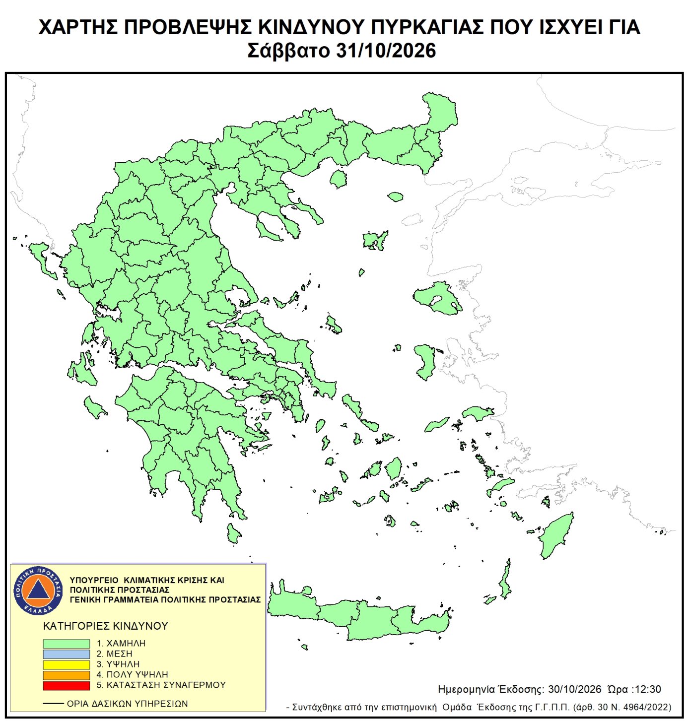
Map: Ministry of Climate Crisis and Civil Protection (CC BY-NC-SA 4.0) The map on civilprotection.gov.gr
Municipalities in Attica
- Low Category 1 of 5
- Acharnes, Aegina, Agia Paraskevi, Agia Varvara, Agioi Anargyroi - Kamatero, Agios Dimitrios, Agkistri, Aigaleo, Alimos, Aspropyrgos, Athens, Chaidari, Chalandri, Dafni - Ymittos, Dionysos, Elefsina, Elliniko - Argyroupoli, Filothei - Psychiko, Fyli, Galatsi, Glyfada, Hydra, Ilion, Ilioupoli, Irakleio, Kaisariani, Kallithea, Keratsini - Drapetsona, Kifisia, Korydallos, Kropia, Kythira, Lavreotiki, Lykovrysi - Pefki, Mandra - Eidyllia, Marathonas, Markopoulo Mesogaias, Marousi, Megara, Metamorfosi, Moschato - Tavros, Nea Filadelfeia - Nea Chalkidona, Nea Ionia, Nea Smyrni, Nikaia - Agios Ioannis Rentis, Oropos, Paiania, Palaio Faliro, Pallini, Papagou - Cholargos, Penteli, Perama, Peristeri, Petroupoli, Piraeus, Poros, Rafina - Pikermi, Salamina, Saronikos, Spata - Artemida, Spetses, Troizinia - Methana, Vari - Voula - Vouliagmeni, Vrilissia, Vyronas, Zografou
What the categories mean
The map shows how likely a forest fire is to break out in the next 24 hours, in five categories. It tells the services to be ready, and tells people to avoid anything that could start a fire by accident.
- 1. Low
- 2. Moderate
- 3. High
- 4. Very high
- 5. State of alert
Where lightning strikes forests and woodland, the risk of a fire is higher.
If you see a fire, call 199 (Fire Service) or 112 straight away.
The maps are Civil Protection's, unaltered, and we keep them for 14 days. Every map is on civilprotection.gov.gr/xartis. AthensDash is not affiliated with Civil Protection.